Trail Walking Le Montsaugeonnais - Dans les Bois de Montanson - Vaux sous Aubigny - Photo

Dans les Bois de Montanson - Vaux sous Aubigny

 tracegps
tracegps

User

© OpenStreetMap contributors
Length
Length
11.2 km
Max alt
Max alt
416 m
Uphill gradient
Uphill gradient
291 m
Km-Effort
Km-Effort  
15.1 km
Min alt
Min alt
275 m
Downhill gradient
Downhill gradient
291 m
Boucle
Boucle
Yes
Creation date :
2014-12-10 00:00:00.0
Updated on :
2014-12-10 00:00:00.0

(0 Reviews)

Walking
Walking
2h30
Difficulty : Medium

Scan this QR Code to open this trail in the SityTrail application

FREE GPS app for hiking

Logo SityTrail SityTrail

IGN / Geographical institutes

Download SityTrail from the App Store Download SityTrail from Google Play

Logo SityTrail SityTrail World

The world is yours!

Download SityTrail from the App Store Download SityTrail from Google Play Download SityTrail on Huawei AppGallery

About

Trail Walking of 11.2 km to be discovered at Grand Est, Haute-Marne, Le Montsaugeonnais. This trail is proposed by tracegps.

Description

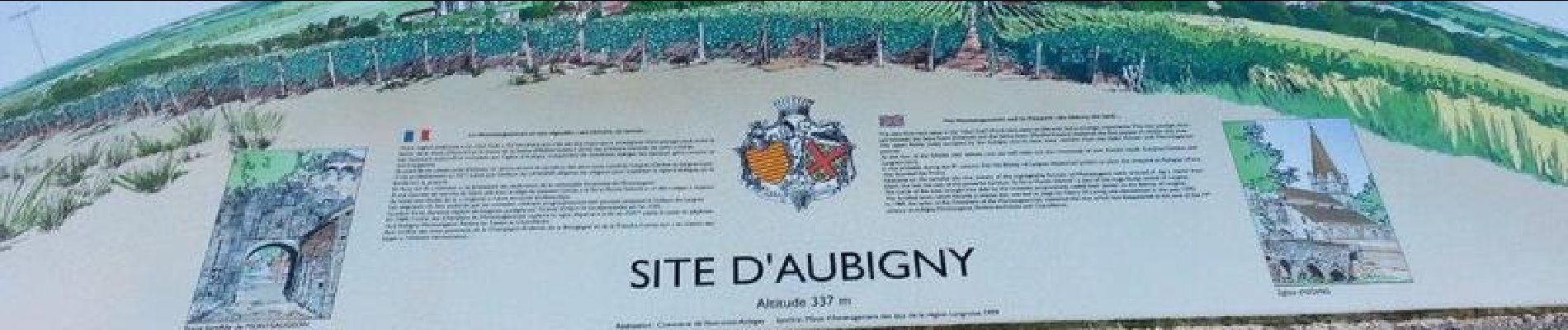
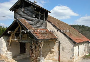
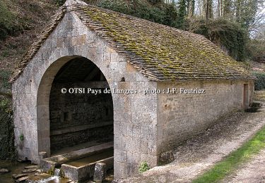
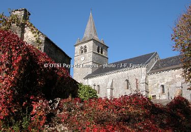
Circuit de marche nordique très varié avec une arrivée près de l'église d'Aubigny au dessus des vignobles du Muid Montsaugeonnais.

Elevation profile

Photos

Positioning

Country:
France
Region :
Grand Est
Department/Province :
Haute-Marne
Municipality :
Le Montsaugeonnais
Location:
Unknown
Start:(UTM)
671518 ; 5280586 (31T) N.

Trails nearby

Trail Cycle Le Montsaugeonnais - De la Coulange au Badin - Vaux - sous - Aubigny - Photo
Cycle
tracegps

Cycle

Medium
Le Montsaugeonnais, Grand Est, Haute-Marne, France
30 km | 36 km-effort
2h 30min
Yes
Trail Mountain bike Le Montsaugeonnais - Les Grandes Charmes - Photo
Mountain bike
tracegps

Mountain bike

Medium
Le Montsaugeonnais, Grand Est, Haute-Marne, France
16.2 km | 20 km-effort
2h 0min
Yes
Trail Walking Le Montsaugeonnais - Les Grandes Charmes - Photo
Walking
tracegps

Walking

Difficult
Le Montsaugeonnais, Grand Est, Haute-Marne, France
16.2 km | 20 km-effort
4h 0min
Yes
Trail Mountain bike Dommarien - Le creux de la Chaudière - Dommarien - Chassigny - Photo
Mountain bike
tracegps

Mountain bike

Medium
Dommarien, Grand Est, Haute-Marne, France
13.1 km | 15.8 km-effort
1h 45min
Yes
Trail Walking Dommarien - Le creux de la Chaudière - Dommarien - Chassigny - Photo
Walking
tracegps

Walking

Difficult
Dommarien, Grand Est, Haute-Marne, France
13.1 km | 15.8 km-effort
4h 0min
Yes


Close
My subscriptions